|
Unionoida | Unionoidea | Unionidae | Parreysiinae | Parreysiini | Parreysia species Parreysia rakhinensis Bolotov, Konopleva, Vikhrev, Gofarov, Lopes-Lima, Bogan, Lunn, Chan, Win, Aksenova, Tomilova, Tanmuangpak, Tumpeesuwan & Kondakov, 2020: specimens
1 nominal species
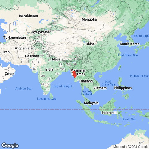
Range: Coastal streams of the Bay of Bengal, Myanmar. Map of Georeferenced Specimens
 |
There are no specimens in the MUSSELpdb for this species.
Genbank Vouchers
MyanmarRMBH_biv_652_1 (COI, 16S, 28S) MYANMAR: Kyeintali Stream upstream of Ohtein village, 17.9193°N, 94.5946°E RMBH_biv_660_3 (COI, 16S, 28S) Myanmar: tributary of the Ann River, 19.8035°N, 94.0460°E RMBH_biv_656 (COI, 16S, 28S) MYANMAR: Thandwe River near Ywar Shai village, 18.3741°N, 94.4952°E RMBH_biv_655_2 (COI) MYANMAR: Thandwe River near Ywar Shai village, 18.3741°N, 94.4952°E RMBH_biv_658_1 (COI) Myanmar: Toungup River, 18.8439°N, 94.3447°E RMBH_biv_657_3 (COI) Myanmar: Shwehle Stream, 18.6174°N, 94.3508°E RMBH_biv_657_2 (COI) Myanmar: Shwehle Stream, 18.6174°N, 94.3508°E RMBH_biv_655_1 (COI) MYANMAR: Thandwe River near Ywar Shai village, 18.3741°N, 94.4952°E RMBH_biv_655_3 (COI) MYANMAR: Thandwe River near Ywar Shai village, 18.3741°N, 94.4952°E RMBH_biv_654_1 (COI) [Myanmar] Sa Lu Stream, 18.1631°N, 94.4997°E RMBH_biv_653_2 (COI) MYANMAR: Sa Lu Stream, 18.1631°N, 94.4997°E RMBH_biv_652_6 (COI) MYANMAR: Kyeintali Stream upstream of Ohtein village, 17.9193°N, 94.5946°E RMBH_biv_653_3 (COI) MYANMAR: Sa Lu Stream, 18.1631°N, 94.4997°E RMBH_biv_659_2 (COI) Myanmar: Ann River near Ann town, 19.8026°N, 94.0449°E RMBH_biv_657_1 (COI) Myanmar: Shwehle Stream, 18.6174°N, 94.3508°E RMBH_biv_652_3 (COI) MYANMAR: Kyeintali Stream upstream of Ohtein village, 17.9193°N, 94.5946°E RMBH_biv_658_3 (COI) Myanmar: Toungup River, 18.8439°N, 94.3447°E RMBH_biv_652_2 (COI) MYANMAR: Kyeintali Stream upstream of Ohtein village, 17.9193°N, 94.5946°E RMBH_biv_659_3 (COI) Myanmar: Ann River near Ann town, 19.8026°N, 94.0449°E RMBH_biv_659_1 (COI) Myanmar: Ann River near Ann town, 19.8026°N, 94.0449°E RMBH_biv_660_1 (COI) Myanmar: tributary of the Ann River, 19.8035°N, 94.0460°E RMBH_biv_652_4 (COI) MYANMAR: Kyeintali Stream upstream of Ohtein village, 17.9193°N, 94.5946°E RMBH_biv_658_2 (COI) Myanmar: Toungup River, 18.8439°N, 94.3447°E RMBH_biv_654_2 (COI) Sa Lu Stream, 18.1631°N, 94.4997°E RMBH_biv_660_2 (COI) Myanmar: tributary of the Ann River, 19.8035°N, 94.0460°E RMBH_biv_653_1 (COI) MYANMAR: Sa Lu Stream, 18.1631°N, 94.4997°E
|