|
Unionoida | Unionoidea | Unionidae | Ambleminae | Lampsilini | Potamilus species Potamilus inflatus (Lea, 1831): specimens
3 nominal species as synonyms
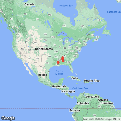
Range: Mobile Basin, eastern Gulf Coastal Plain, USA. Map of Georeferenced Specimens
 |
Genbank Vouchers
USAUF_439131-10458 (COI, ND1, 28S, ITS1, 5.8S, SRA) USA, Alabama, Marengo/Sumter, Mouth of Foscue Creek/Tombigbee River approximately 0.5 miles upstream of Demopolis L and D- Dredge site (USCG/US Corps Facilities) (32.51715, -87.86976) UF_439131-10456 (COI, ND1, 28S, ITS1, 5.8S) Tombigbee River, Mobile drainage (32.5172, -87.8698) UF_439531-PinfAmi012 (COI, ND1, ITS1, 5.8S) USA, Louisiana, Livingston Parish, Amite River (30.38867, -90.96779) UF_439131-PinfMob005 (COI, ND1, ITS1, 5.8S) USA, Alabama, Marengo/Sumter, Mouth of Foscue Creek/Tombigbee River approximately 0.5 miles upstream of Demopolis L and D- Dredge site (USCG/US Corps Facilities) (32.51715, -87.86976) UF_439532-PinfAmi014 (COI, ND1, ITS1, 5.8S) USA, Louisiana, Livingston Parish, Amite River (30.41718, -90.9643) UF_439131-PinfMob003 (COI, ND1, ITS1, 5.8S) USA, Alabama, Marengo/Sumter, Mouth of Foscue Creek/Tombigbee River approximately 0.5 miles upstream of Demopolis L and D- Dredge site (USCG/US Corps Facilities) (32.51715, -87.86976) UF_439513-PinfMob017 (COI, ND1, ITS1, 5.8S) USA, Alabama, Tuscaloosa County, Black Warrior River between US Hwy 82 and AL Hwy 69 bridge (33.22022, -87.55038) UF_439514-PinfMob019 (COI, ND1, ITS1, 5.8S) USA, Alabama, Tuscaloosa County, Black Warrior River near Moundville Archaeological Park (33.00965, -87.63561) UF_439514-PinfMob021 (COI, ND1, ITS1, 5.8S) USA, Alabama, Tuscaloosa County, Black Warrior River near Moundville Archaeological Park (33.00965, -87.63561) UF_439513-PinfMob018 (COI, ND1, ITS1, 5.8S) USA, Alabama, Tuscaloosa County, Black Warrior River between US Hwy 82 and AL Hwy 69 bridge (33.22022, -87.55038) UF_439514-PinfMob020 (COI, ND1, ITS1, 5.8S) USA, Alabama, Tuscaloosa County, Black Warrior River near Moundville Archaeological Park (33.00965, -87.63561) UF_439514-PinfMob023 (COI, ND1, ITS1) USA, Alabama, Tuscaloosa County, Black Warrior River near Moundville Archaeological Park (33.00965, -87.63561) UF_439530-PinfAmi010 (COI, ND1, ITS1) USA, Louisiana, Livingston Parish, Amite River (30.40467, -90.95933) UF_439131-PinfMob006 (COI, ND1, ITS1) USA, Alabama, Marengo/Sumter, Mouth of Foscue Creek/Tombigbee River approximately 0.5 miles upstream of Demopolis L and D- Dredge site (USCG/US Corps Facilities) (32.51715, -87.86976) UF_439532-PinfAmi013 (COI, ND1, ITS1) USA, Louisiana, Livingston Parish, Amite River (30.41718, -90.9643) UF_439514-PinfMob022 (COI, ND1, ITS1) USA, Alabama, Tuscaloosa County, Black Warrior River near Moundville Archaeological Park (33.00965, -87.63561) UF_439131-PinfMob001 (COI, ND1, ITS1) USA, Alabama, Marengo/Sumter, Mouth of Foscue Creek/Tombigbee River approximately 0.5 miles upstream of Demopolis L and D- Dredge site (USCG/US Corps Facilities) (32.51715, -87.86976) UF_439533-PinfAmi015 (COI, ND1, ITS1) USA, Louisiana, Livingston Parish, Amite River (30.42666, -90.98211) UF_439530-PinfAmi011 (COI, ND1, ITS1) USA, Louisiana, Livingston Parish, Amite River (30.40467, -90.95933)
UA2696-PinfMob016 (ND1, ITS1, 5.8S)
|
