|
Unionoidea | Unionidae | Ambleminae | Quadrulini | Quadrulina | Pustulosa species Pustulosa infucata (Conrad, 1834): specimens
2 nominal species as synonyms
Taxonomic History (since 2007)
Quincuncina infucata — Zhou et al. (2007), Graf & Cummings (2007), Cummings & Graf (2010), ITIS (2012), Szumowski et al. (2012)
Quadrula infucata — Williams et al. (2008), Bogan (2010), Williams et al. (2011), Haag (2012), Williams et al. (2014)
Rotundaria infucata — Campbell & Lydeard (2012), Campbell & Lydeard (2012)
Amphinaias infucata — ITIS (2013)
Cyclonaias infucata — Williams et al. (2017), Johnson et al. (2018), Lopes-Lima et al. (2019), Graf & Cummings (2021), FMCS (2021), Hopper et al. (2023)
Pustulosa infucata — Neemuchwala et al. (2023), FMCS (2025)
|
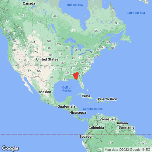
Range: Apalachicola and Ochlockonee rivers, Alabama, Georgia, and Florida, USA. Map of Georeferenced Specimens
 |
USA |

USNM_84037
Macon County; Georgia; United States
|
|
|
Genbank Vouchers
USAUF_438764 (QinfChi019) (COI, ND1, ITS1, 5.8S) USA, Alabama, Houston County, Cowarts Creek on Rocky Creek Road ENE of Cottonwood (31.07521, -85.21861) UF_438764 (QinfChi015) (COI, ND1, ITS1, 5.8S) USA, Alabama, Houston County, Cowarts Creek on Rocky Creek Road ENE of Cottonwood (31.07521, -85.21861) UF_438351 (QinfOch024) (COI, ND1, ITS1, 5.8S) USA, Florida, Gadsden County, Ochlockonee River about 150 m upstream of US 90 bridge (30.47529, -84.40481) UF_438029 (QinfChi032) (COI, ND1, ITS1, 5.8S) USA, Florida, Gulf County, Chipola River about 2.9 air miles E of Wewahitchka (30.11459, -85.1709) UF_438029 (QinfChi031) (COI, ND1, ITS1, 5.8S) USA, Florida, Gulf County, Chipola River about 2.9 air miles E of Wewahitchka (30.11459, -85.1709) UF_438029 (QinfChi030) (COI, ND1, ITS1, 5.8S) USA, Florida, Gulf County, Chipola River about 2.9 air miles E of Wewahitchka (30.11459, -85.1709) UF_438764 (QinfChi017) (COI, ND1, ITS1, 5.8S) USA, Alabama, Houston County, Cowarts Creek on Rocky Creek Road ENE of Cottonwood (31.07521, -85.21861) UF_438029 (QinfChi033) (COI, ND1, ITS1, 5.8S) USA, Florida, Gulf County, Chipola River about 2.9 air miles E of Wewahitchka (30.11459, -85.1709) UF_438331 (QinfOch021) (COI, ND1, ITS1, 5.8S) USA, Florida, Leon County, Ochlockonee River at upper end of Lake Talquin about 200 m upstream of I10 bridge (30.48789, -84.39746) UF_440951 (QinfFli011) (COI, ND1, ITS1, 5.8S) USA, Georgia, Baker/Mitchell County, Flint River, about 1 mi. upstream of mouth of Ichawaynochaway Creek. (31.1703, -84.456) UF_440951 (QinfFli010) (COI, ND1, ITS1, 5.8S) USA, Georgia, Baker/Mitchell County, Flint River, about 1 mi. upstream of mouth of Ichawaynochaway Creek. (31.1703, -84.456) UF_438721 (QkleOch001) (COI, ND1, ITS1, 5.8S) USA, Florida, Wakulla/Liberty County, Ochlockonee River on left descending bank (LDB) about 500 m below Silver Lake Landing boat ramp (30.065711, -84.615969) UF_438520 (QinfChi007) (COI, ND1, ITS1, 5.8S) USA, Florida, Jackson County, Sugar Mill Spring Run in Florida Caverns State Park North of Marianna (30.8222, -85.2439) UF_438393 (QinfOch022) (COI, ND1, ITS1, 5.8S) USA, Florida, Liberty/Wakulla Cos., Ochlockonee River 1.1 RM upstream of Telogia Creek confluence (30.27568, -84.72896) UF_438351 (QinfOch026) (COI, ND1, ITS1, 5.8S) USA, Florida, Gadsden County, Ochlockonee River about 150 m upstream of US 90 bridge (30.47529, -84.40481) UF_438764 (QinfChi016) (COI, ND1, ITS1, 5.8S) USA, Alabama, Houston County, Cowarts Creek on Rocky Creek Road ENE of Cottonwood (31.07521, -85.21861) UF_438764 (QinfChi020) (COI, ND1, ITS1, 5.8S) USA, Alabama, Houston County, Cowarts Creek on Rocky Creek Road ENE of Cottonwood (31.07521, -85.21861) UF_438982 (QinfChi028) (COI, ND1, ITS1, 5.8S) USA, Florida, Jackson County, Dry Creek at Iron Bridge Road (30.674478, -85.208681) UF_441246 (QinfFli034) (COI, ND1, ITS1, 5.8S) USA, Alabama, Houston County, Big Creek at St. Hwy 109, just E of Merritts Crossroads, 3 mi. S of Rehobeth, AL (31.07772, -85.45664) UF_440951 (QinfFli009) (COI, ND1, ITS1, 5.8S) USA, Georgia, Baker/Mitchell County, Flint River, about 1 mi. upstream of mouth of Ichawaynochaway Creek. (31.1703, -84.456) UF_438635 (QinfChi014) (COI, ND1, ITS1, 5.8S) USA, Alabama, Houston County, Big Creek about 400 m upstream of Co. Rt 55 bridge about 5 km SW of Cottonwood (31.02714, -85.35429) UAUC_561 (COI, 16S) Kinchafoonee Creek, Flint River, Georgia UAUC_919-926 (COI, 16S) Ocklockonee River, Florida UAUC_605 (COI, 16S) Kinchafoonee Creek, Flint River, Georgia UAUC_3283 (ND1) Flint River, Cooleewahee Ck., GA Rt. 91 bridge, Baker Co. GA UAUC_920 (ND1) Ochlocknee R., Leon Co., Florida UF_440951 (SRA) USA, Georgia, Baker/Mitchell County, Flint River, about 1 mi. upstream of mouth of Ichawaynochaway Creek. (31.1703, -84.456)
|