| Page last updated
Sun 07 Sep 2025 |
The Freshwater Mussels (Unionoida) of the World (and other less consequential bivalves)
FM(U)otW(aolcb) is the web version of the MUSSEL Project Database. Follow the links to browse the data or use the custom Google search field. Either way, you win!
This page reports the specimens in the MUSSELpdb and provides a map if geocodes are known. The taxonomic history reports the record of different names and combinations that have been applied to this species (and its synonyms) since 2007. The MUSSEL Project Database has moved to a new server, with a new URL! The new address for this page is: https://musselpdb.org/db.php?ty=validsp&id=605
Search the database pages:
|
|
Bivalvia | Unionoida | Etherioidea | Mycetopodidae | Anodontitinae | Anodontites species Anodontites crispata Bruguière, 1792: specimens
9 nominal species as synonyms
Range: Widespread in tropical South America, from the Amazon and north. Map of Georeferenced Specimens
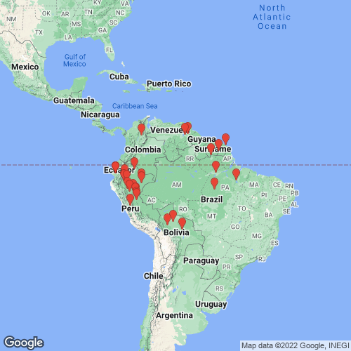 |
Bolivia |

USNM_86732
Bolivia
|

INHS_18224
Rio Chaparina (Rio Amazon - Rio Yacuma Dr.), 11 km W San Borja, Beni, Bolivia
|

INHS_17841
Rio Matos (Rio Amazon - Rio Apere Dr.), 6 km E Estación Biologica del Beni on rd. to San Ignacio, Beni, Bolivia
|

UF_93330
Rio Zapacos, 3 km W Asencion, Nuflo de Chavez Province, Santa Cruz Departemento, Bolivia
|
|
|
Brazil |

MCZ_238326
a bush creek on West Paru River, Apisike, Brazil (near the Suriname border)
|

ANSP_125453
Amazon River
|
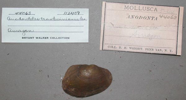
UMMZ_112409
Amazon
|
|
INPA_1390 Brazil: Pará: (Amazon - Tapajós - Jamanxim): igarapé do Limão: afluente do Jamanxim, afluente do Tapajós
INPA_1389 Brazil: Pará: (Amazon - Tapajós - Jamanxim): igarapé do Limão: afluente do Jamanxim, afluente do Tapajós -06.15456, -55.03601
INPA_185 Brazil: Pará: Tucuruí: (Tocantins): rio Caraipé
FMNH_34849 Paraná de Almequer, Pará, Brazil
|
Colombia |

USNM_380695
Colombia, from a small stream in dense jungle, 13 kilometers S of Puerto Santos, Prov. Santander del Norte
|

MNHN_MP_0360
Colombia
|
|
|
USNM_380702 Colombia, from a small stream in dense jungle, 13 kilometers S of Puerto Santos, Prov. Santander del Norte
|
Ecuador |

FMNH_173059
Rio Cusuimi, Cusuimi, 150 km SE Puyo, Departmento de Pastaza, Ecuador; 2°50’S, 77°25’E
|

FMNH_179994
Rio Cusuimi, Cusuimi, 150 km SE Puyo, Departmento de Pastaza, Ecuador; 2°50’S, 77°40’W
|

ZMB_MP_0159
Ecuador
|

BMNH_1876-6-21-2
Guayaquil, Ecuador
|

UMMZ_112386
Ecuador, South America
|

UMMZ_112390
Ecuador, South America
|

UMMZ_112391
Upper Daule, branch of the Guayaquil River, Ecuador
|

MCZ_MP.170
Ecuador
|

SMF_11955
Rio Bodega [Bodegas], Ecuador, Pazifisch Seite
|

SMF_11957
Rio Napo, Ecuador, Amazonas Geb.
|

SMF_11959
Rio Unuyacu, Ecuador, Amazonas Geb.
|

USNM_25429
Rio Napo, Ecuador
|

USNM_126997
Ecuador
|
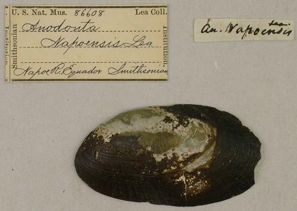
USNM_86608
Napo R., Ecuador
|

IRSNB_MP_0946
Equateur
|

MNHN_MP_0658
Guayaquil [Ecuador]
|

ANSP_366273
Upper Daule, Ecuador
|

ANSP_366274
Upper Daule, Ecuador
|

ZMB_50835
Ecuador
|
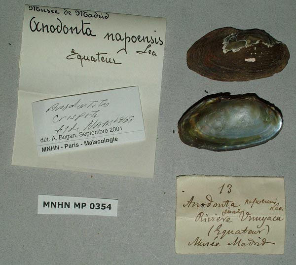
MNHN_MP_0354
Riviere Unuyacu, Equateur
|
|
French Guiana |

MNHN_MPL_0038
Cayenne ? “Habite... les régions australes? Du voyage de Baudin. Mus. n°. Mon cabinet.” ["Lives... the southern regions? The Baudin voyage. Mus. No.. My cabinet.
|

USNM_86402
Cayenne
|

USNM_86403
Cayenne
|

ANSP_125437
Cayenne
|

SMF_11960
Cayenne, Franz Guayana
|

MNHN_MP_0359
Tampoc (affluent Maroni)
|
Guyana |
|
MHNG-MOLL-50585 Rivières de la Guyanne
|
Peru |

FMNH_36291
near Pucalpa, Peru
|

FMNH_30073
Rio Ucayali, Metelo Yacu, near Cerro Azul, Departmento de Loreto, Peru
|

SMF_83018
Peru
|
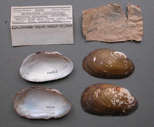
FMNH_30072
Rio Ucayali, Metelo Yacu, near Cerro Azul, Departmento de Loreto, Peru
|

FMNH_30651
Rio Ucayali, Metelo Yacu, near Cerro Azul, Departmento de Loreto, Peru
|
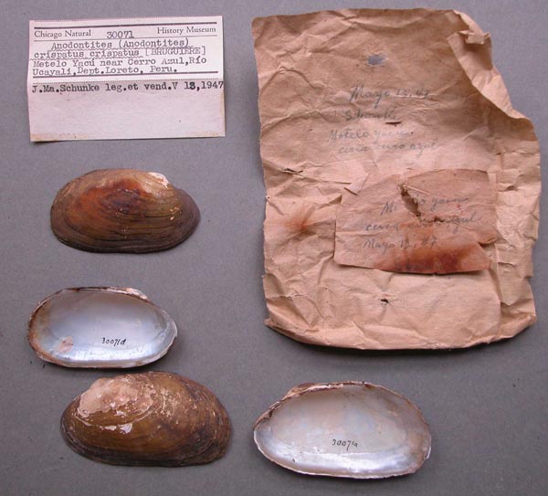
FMNH_30071
Rio Ucayali, Metelo Yacu, near Cerro Azul, Departmento de Loreto, Peru
|
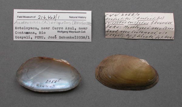
FMNH_216663
Rio Ucayali, Metelo Yacu, near Cerro Azul, near Contamana, Departmento de Loreto, Peru
|
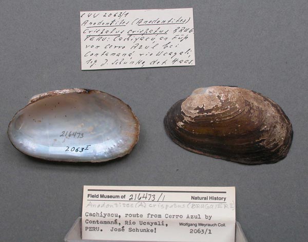
FMNH_216473
Rio Ucayali, Cachiyacu, route from Cerro Azul by Contamana, Departmento de Loreto, Peru
|

MCZ_MP.162
Quebrada Turicana, Rio Pachitea, Aqua Caliente, Huanuco, Peru
|

SMF_83014
Pazif. Seite v Peru
|

UMMZ_112389
Peru, South America
|

UF_28155
Rio Santiago, Galilea, in Cocha, Amazonas, Peru
|

UMMZ_4394
Juan Guerra, Peru
|

UF_28156
Rio Santiago, Galilea, in Cocha, Amazonas, Peru
|

MCZ_MP.174
Agua Blanca, Huanuco, Peru
|

MCZ_MP.182
Rio Pachitea, Cinco Copal, Agua Caliente, Huanuco, Peru
|

MCZ_MP.185
Agua Caliente, near Isla Chonta, Huanuco, Peru
|

MCZ_MP.186
Agua Caliente, near Isla Chonta, Huanuco, Peru
|

UF_270531
Valley of Mayobamba, Rio Mayo, Peru
|

ZMB_37657
Ucayali
|

INHS_19818
Rio Itaya, 11 km (39° bearing) SSE center of Iquitos, Loreto, Peru
|

INHS_19828
Rio Itaya, 11 km (39° bearing) SSE center of Iquitos, Loreto, Peru
|

INHS_19826
Rio Itaya, 11 km (39° bearing) SSE center of Iquitos, Loreto, Peru
|

USNM_5933
Peru
|

AMNH_89103
Rio Aspusana, below lower Ponguito, Peru
|

AMNH_89110
along water line at Tierra Blanca, Peru
|
|
Venezuela |

INHS_17031
Caño Casuapo, on rd. from Upata to El Manteco, Bolivar, Venezuela
|

INHS_14955
Rio Guanare, El Miamo, Bolivar, Venezuela
|
|
unknown |

SMF_11958
[no locality available - South America]
|
|
|
|
Page updated: 08:19:28 Sun 07 Sep 2025 |
|