| Page last updated
Sun 07 Sep 2025 |
The Freshwater Mussels (Unionoida) of the World (and other less consequential bivalves)
FM(U)otW(aolcb) is the web version of the MUSSEL Project Database. Follow the links to browse the data or use the custom Google search field. Either way, you win!
This page reports the specimens in the MUSSELpdb and provides a map if geocodes are known. The taxonomic history reports the record of different names and combinations that have been applied to this species (and its synonyms) since 2007. The MUSSEL Project Database has moved to a new server, with a new URL! The new address for this page is: https://musselpdb.org/db.php?ty=validsp&id=2772
Search the database pages:
|
|
Unionoida | Unionoidea | Unionidae | Ambleminae | Popenaiadini | Nephronaias species Nephronaias dysonii (Lea, 1859): specimens
1 nominal species
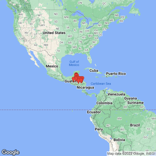
Range: Honduras and possibly Costa Rica. Map of Georeferenced Specimens
 |
Belize |

MCZ_59651
Gongora River, British Honduras
|

UF_184065
Booths River, just upstream junct. with Rio Bravo, Orange Walk Dist., Belize
|

UF_243984
Chan Chich Creek (Rio Bravo), nr. Gallon Jug, nr. Chan Chich Lodge, Orange Walk District, Belize
|

FMNH_21860
Belize, British Honduras
|

INHS_27987
Aguacate River, rm 25, NE Aguacate, Toledo, Belize
|

USNM_382726
Manatee River, British Honduras
|

UMMZ_60443
Punta Gorda, British Honduras
|

UMMZ_57487
Punta Gorda, British Honduras
|

FMNH_21864
Punta Gorda, British Honduras
|

FMNH_120429
British Honduras
|

FMNH_90080
Punta Gorda, British Honduras
|

INHS_23097
Macal River, 12 mi S Augustine, Cayo, Belize
|

UMMZ_57486
Punta Gorda, British Honduras
|

UMMZ_60368
Belize, British Honduras
|

INHS_27586
Aguacate River, rm 25, NE Aguacate, Toledo, Belize
|

INHS_36540
Aguacate River, 19 mi WNW Punta Gorda, Toledo, Belize
|

INHS_36541
Aguacate River, 19 mi WNW Punta Gorda, Toledo, Belize
|

INHS_46385
creek, Pueblo Viejo, 38.3 km WNW Punta Gorda, Toledo District, Belize
|

INHS_46386
Central Belize
|

UF_517939
Chan Chich Creek> Rio Bravo> Bahia de Chetumal Near Chan Chich Lodge near Gallon Jug Orange Walk District, Belize `18oN, ~87oW
|

UF_517940
Rio Bravo> Bahia de Chetumal Cedar Crossing on Gallon Jug Rd., Rio Bravo Cons. Area Orange Walk District, Belize ~18oN, ~87oW
|

UF_517940B
Rio Bravo> Bahia de Chetumal Cedar Crossing on Gallon Jug Rd., Rio Bravo Cons. Area Orange Walk District, Belize ~18°N, ~87°W
|

BMNH_89-12-7-19
British Honduras
|

BMNH_97-7-6-1-4
Yalbac River, Western District, British Honduras
|

FMNH_21861
Punta Gorda, British Honduras
|

UF_201624
Indian Creek, at S Hwy, 8.1 km NE Indian Cr. Village, Toledo District, Belize 16° 21.7’ N, 88° 48.0’ W
|

UF_207222
Rio Bravo, Cedar Crossing, 21 km S Rio Bravo Research Station, Orange Walk Dist., Belize 17° 41.4’ N, 89° 02.0’ W
|

USNM_664687
British Honduras
|

UF_207223
Rio Bravo, Cedar Crossing, 21 km S Rio Bravo Research Station, Orange Walk Dist., Belize 17° 41.4’ N, 89° 02.0’ W
|

UF_207283
Rio Bravo, Sylvesters Camp Orange Walk Dist., Belize 17° 35.5’ N, 89° 05.6’ W
|

UF_207284
Rio Bravo, Sylvesters Camp Orange Walk Dist., Belize 17° 35.5’ N, 89° 05.6’ W
|

UF_207299
creek, 16.6 km WSW Rancho Dolores, Orange Walk District, Belize 17° 30.5’ N, 88° 43.7’ W
|

UF_207303
creek, 16.6 km WSW Rancho Dolores, Orange Walk District, Belize 17° 30.5’ N, 88° 43.7’ W
|

UF_207623
Indian Creek, at S Hwy, 8.1 km NE Indian Cr. Village, Toledo District, Belize 16° 21.7’ N, 88° 48.0’ W
|

UF_207624
Indian Creek, at S Hwy, 8.1 km NE Indian Cr. Village, Toledo District, Belize 16° 21.7’ N, 88° 48.0’ W
|

UF_207626
Hickatee Creek, trib. of Rio Bravo, 5.7 km NE Big Falls Village, Toledo District, Belize 16° 17.7’ N, 88° 52.0’ W
|

UF_207629
Rio Grande, Big Falls, Toledo District, Belize 16° 15.3’ N, 88° 53.2’ W
|

UF_207726
Moho River, 1.3 km W Santa Anna, Toledo District, Belize 16° 05.9’ N, 88° 56.9’ W
|

UF_207820
Aguacate River [Moho River], 6.2 km S Blue Creek Village, Toledo District, Belize 16° 08.9’ N, 89° 00.9’ W
|

UF_207821
Aguacate River [Moho River], 6.2 km S Blue Creek Village, Toledo District, Belize 16° 08.9’ N, 89° 00.9’ W
|

UF_207913
Rio Grande, Big Falls, Toledo District, Belize 16° 15.3’ N, 88° 53.2’ W
|

USNM_150380
small stream near Punta Gorda, Belize
|

USNM_193019
Yaalback Cr., Cayo Distr., Honduras
|
|
|
Guatemala |

ZMB_MP_0508
Tehuantepec, Coban, Vera Paz, Guatemala
|

ANSP_45419
Saja River, a trib of the Rio Dulce, Nicaragua
|

MCZ_MP_271
Guatemala
|

MCZ_MP_287
Saja River (trib. to Dulce River) 4 or 5 mi W Esmeralda, Guatemala
|

NCSM_6244
North America, Guatemala, Rio Saja (Mullee River Dr.), 4-5 mi W of Esmeralda
|

INHS_21772
Saja River, Esmeralda, Guatemala
|

INHS_21773
Saja River (trib. to Dulce River) 4 or 5 mi W Esmeralda, Guatemala
|

MCZ_21169
Rio Saja, Nicaragua
|

UMMZ_108010
Rio Saja, 5 mi W Esmeralda, Guatemala
|

FMNH_68188
Rio Saja, 5 mi W Esmeralda, Guatemala
|

ANSP_145239
Rio Saja, 5 mi W Esmeralda, Guatemala
|

MCZ_45420
Rio Saja, trib. to Rio Dulce, W of Esmeralda, Guatemala
|
Honduras |

ANSP_129445
Branch of Chamelecon River, Honduras
|

MCZ_MP_282
edge of Ulua River, Carozal, Honduras
|

MCZ_MP_290
Rio Humuya, Comayagua, Honduras
|

USNM_215593
La Ceiba, Honduras
|

UF_270354
Rio Ulua, Honduras
|

FMNH_29002
Rio Humuya, Comayagua, Honduras
|

BMNH_1965173
Honduras
|

MCZ_MP_270
Honduras
|

HMC_1861_01
unknown river> Caribbean Sea no specific site given, Honduras
|

HMC_1861_02
unknown river> Caribbean Sea no specific site given, Honduras
|

UF_194241
Rio Sulaco, branch of Cajon Reservior, Yoro Dept., Honduras 14° 01’ 11’ N, 87° 30’ 19” W
|

UF_194521
Rio Guayape, 10 km SE Catacamas, Olancho Dept., Honduras 14° 45’ 43” N, 85°, 53’ 07” W
|

UF_194522
Rio Guayape, 10 km SE Catacamas, Olancho Dept., Honduras 14° 45’ 43” N, 85°, 53’ 07” W
|

UF_194524
Rio Guayape, 9 km ENE Juticalpa, Olancho Dept., Honduras 14° 43’ 11” N, 86°, 08’ 43” W
|

UF_211977
2.6 km SW La Brea, Colon Department, Honduras 15° 45’ 39” N, 86° 00’ 08” W
|

UF_22127
Quebrada Grande, 8.5 km W San Juan, Atlantida Department, Honduras
|

UF_221378
small creek, Icoteas, ca. 17 km E Limon on road to Iriona, Colon Department, Honduras
|

UF_221379
small creek, Icoteas, ca. 17 km E Limon on road to Iriona, Colon Department, Honduras
|

UF_221530
Rio Guayape, 11 km SSE Catacamas, Olancho Department, Honduras
|
|
|
|
BMNH_1965174 Honduras
|
unknown |

UMMZ_107976
[no locality available - Central America]
|
|
|
|
Page updated: 08:26:09 Sun 07 Sep 2025 |
|