|
Unionoidea | Unionidae | Ambleminae | Quadrulini | Quadrulina | Pustulosa species Pustulosa kieneriana (Lea, 1852): specimens
4 nominal species as synonyms
Taxonomic History (since 2007)
Amphinaias asperata — Graf & Cummings (2007), Cummings & Graf (2010)
Quadrula asperata — Zhou et al. (2007), Williams et al. (2008), Bogan (2010), Haag (2012), ITIS (2012), Szumowski et al. (2012)
Quadrula kieneriana — Williams et al. (2008), Bogan (2010), Szumowski et al. (2012)
Amphinaias keineriana — ITIS (2013)
Cyclonaias kieneriana — Williams et al. (2017), Lopes-Lima et al. (2019), Graf & Cummings (2021), FMCS (2021), Bieler (2021), Hopper et al. (2023), Hauck et al. (2023)
Cyclonaias asperata — Williams et al. (2017), Johnson et al. (2018), Hauck et al. (2023)
Pustulosa kieneriana — Neemuchwala et al. (2023)
|
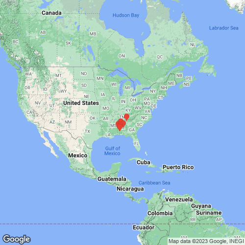
Range: Coosa River, Alabama and Georgia, USA. Map of Georeferenced Specimens
 |
Genbank Vouchers
USAUF_438236 (QaspAla008) (COI, ND1, ITS1, 5.8S) USA, Alabama, Monroe County, Alabama River at RM 71, first bend in river downstream of Claiborne Lock & Dam; UTM Zone 16 3496668E, 447857N (31.603941, -87.54968) UF_438660 (QaspAla001) (COI, ND1, ITS1, 5.8S) USA, Alabama, Dallas County, Bogue Chitto Creek about 400 m above AL Hwy 22 crossing (32.31001, -87.27863) UF_438236 (QaspAla007) (COI, ND1, ITS1, 5.8S) USA, Alabama, Monroe County, Alabama River at RM 71, first bend in river downstream of Claiborne Lock & Dam; UTM Zone 16 3496668E, 447857N (31.603941, -87.54968) UF_438236 (QaspAla006) (COI, ND1, ITS1, 5.8S) USA, Alabama, Monroe County, Alabama River at RM 71, first bend in river downstream of Claiborne Lock & Dam; UTM Zone 16 3496668E, 447857N (31.603941, -87.54968) UF_438211 (QaspAla012) (COI, ND1, ITS1, 5.8S) USA, Alabama, Shelby County, Cahaba River at "Gate Shoals," 1.8 air miles NNW of Marvel, AL (33.17005, -87.01675) UF_438660 (QaspAla002) (COI, ND1, ITS1, 5.8S) USA, Alabama, Dallas County, Bogue Chitto Creek about 400 m above AL Hwy 22 crossing (32.31001, -87.27863) UAUC_334 (16S, ND1) Coosawattee River, 2.5 mi upstream from Hwy 225 bridge, Gordon Co. GA UAUC_792 (ND1) Alabama R.,Wilcox Co., Alabama UAUC_2712 (ND1) Sucarnoochie Ck., Kemper Co., Mississippi UAUC_784 (ND1) Alabama R., Wilcox Co., Alabama UAUC_333 (ND1) Coosawattee R., Gordon-Murray Co., Georgia UAUC_2503 (ND1) Coosa R., Elmore Co., Alabama UF_438660 (SRA) USA, Alabama, Dallas County, Bogue Chitto Creek about 400 m above AL Hwy 22 crossing (32.31001, -87.27863)
|

