|
Unionoidea | Unionidae | Ambleminae | Quadrulini | Quadrulina | Pustulosa species Pustulosa nodulata (Rafinesque, 1820): specimens
5 nominal species as synonyms
Taxonomic History (since 2007)
Amphinaias nodulata — Graf & Cummings (2007), Cummings & Graf (2010), IUCN (2011)
Quadrula nodulata — Tiemann et al. (2007), Williams et al. (2008), Watters et al. (2009), Bogan (2010), Boyer et al. (2011), Haag (2012), ITIS (2012), Szumowski et al. (2012), McMurray et al. (2012)
Cyclonaias nodulata — Williams et al. (2017), Johnson et al. (2018), Burlakova et al. (2018), Lopes-Lima et al. (2019), Graf & Cummings (2021), FMCS (2021), Hopper et al. (2023)
Pustulosa nodulata — Neemuchwala et al. (2023), FMCS (2025)
|
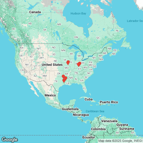
Range: Widespread in the Interior Basin and the western Gulf Coastal Plain, USA. Map of Georeferenced Specimens
 |
Genbank Vouchers
USAUF_439202 (QnodSal023) (COI, ND1, ITS1, 5.8S) USA, Missouri, Ralls County, Salt River approximately 2.0 river miles downstream of Clarence Cannon Dam (39.5254, -91.609) UF_439202 (QnodSal025) (COI, ND1) USA, Missouri, Ralls County, Salt River approximately 2.0 river miles downstream of Clarence Cannon Dam (39.5254, -91.609) UF_439202 (QnodSal021) (COI, ND1) USA, Missouri, Ralls County, Salt River approximately 2.0 river miles downstream of Clarence Cannon Dam (39.5254, -91.609) UF_439180 (QmorRed050) (COI, ND1) USA, Texas, Marion County, Big Cypress Bayou (just downstream from Hwy 59, near Jefferson, TX) (32.739928, -94.441666) UF_439202 (QnodSal024) (COI, ND1) USA, Missouri, Ralls County, Salt River approximately 2.0 river miles downstream of Clarence Cannon Dam (39.5254, -91.609) UF_439197 (QnodNec017) (COI, ND1) USA, Texas, Tyler County, Neches River, backwater near mouth of oxbow (30.659012, -94.170894) UF_439202 (QnodSal022) (COI, ND1) USA, Missouri, Ralls County, Salt River approximately 2.0 river miles downstream of Clarence Cannon Dam (39.5254, -91.609) UF_439197 (QnodNec019) (COI, ND1) USA, Texas, Tyler County, Neches River, backwater near mouth of oxbow (30.659012, -94.170894) UAUC_2592 (ND1) Mississippi R., Marion Co., Missouri UF_439202 (SRA) USA, Missouri, Ralls County, Salt River approximately 2.0 river miles downstream of Clarence Cannon Dam (39.5254, -91.609) UAUC_2595 (ND1) Neches R.,TylerCo.,Texas JBFMC_12104_1 (16S) USA: Louisiana, Bayou Pierre
ASU1245.2 (QnodOua013) (COI, ND1, ITS1, 5.8S) ASU1245.5 (QnodOua016) (COI, ND1, ITS1, 5.8S) ASU1245.3 (QnodOua014) (COI, ND1, ITS1, 5.8S) ASU1245.1 (QnodOua012) (COI, ND1, ITS1, 5.8S) UA_3731 (QaurNec113) (COI, ND1) ASU1245.4 (QnodOua015) (COI, ND1) Mp_2718_Qnod1 (COI) Mp_2718_Qnod2 (COI)
|

